THE VILLAGE
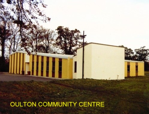
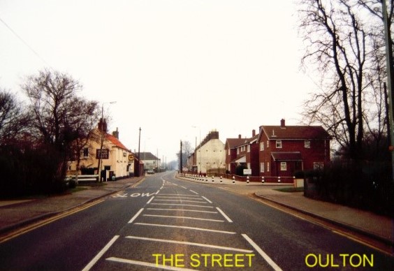
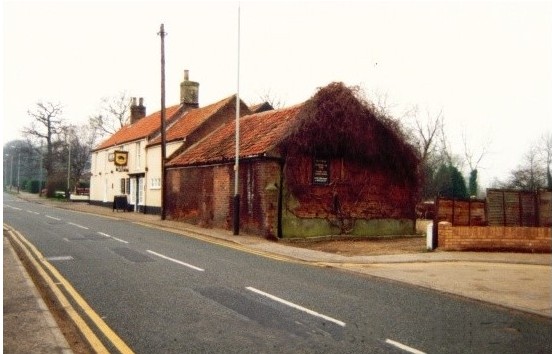

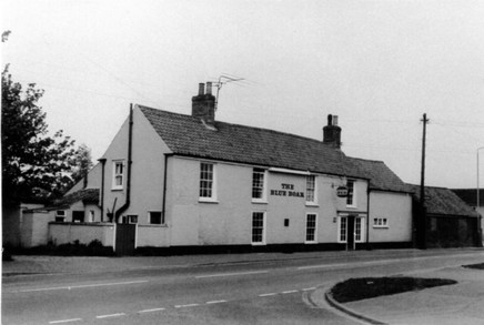
Above: Top three photos taken in the late 1980s. LEFT: Community Centre. CENTRE: The Street heading northwards. RIGHT: The Blue Boar Inn, heading southwards. The attached building is now the restaurant for the pub, it was once a blacksmith's workshop many years ago beside which stood the original Village Pound.
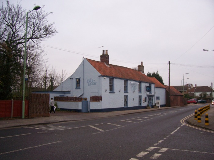
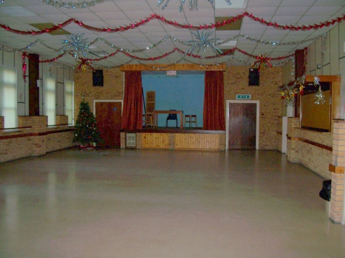
Bottom set of photos above - taken December 2008. LEFT: Community Centre - note the porch which has been added to the main entrance. CENTRE: View of Oulton Road North from Union Lane. RIGHT: The Blue Boar Inn - looking northwards. All photos © W.Robertson
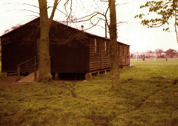
The 'heart' of the village is the Community Centre , in Meadow Road, which is run by the Oulton Community Council - a group of enthusiastic volunteers. It was built in 1975 to replace the large wooden hut which served for many years as a village hall. The centre has a variety of affiliated clubs and organisations who use the centre on a regular basis. The building has one large hall fitted with a stage (there is a bar area, operated by a local licensee, that is used for special functions such as wedding receptions). There is a smaller hall which couples as the Oulton Community Church seating area - the hall being converted to a place of worship when the concertina type screen is opened to reveal the sanctuary altar, a small meeting room - 'the lounge', a fully equipped kitchen and toilet facilities. It is a well run and busy community asset. The Oulton Parish Council meets at 7 p.m. on the first Tuesday of each month (except August) in the small meeting room. During the course of their meetings an 'open forum' is held allowing any parishioner to air their views or concerns. At one time the village had two public houses - the 'Red House' which stood at the junction of The Street and Union Lane - this was demolished in the 1960s. The remaining pub - 'The Blue Boar Inn' dates from the 1600s. Opposite the 'Blue Boar' stands four modern terraced houses, these stand on what was once the pub car park. In the 1800s this area was a bowling green and was owned by the pub. The main thoroughfare through the village (the B1375) is a busy road but when the northern spine road is completed, which will join Millennium Way through to the A12 near Corton Long Lane, perhaps Oulton will once again return to some of the tranquility it enjoyed in years gone by.
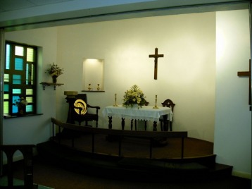
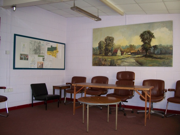
Photos above: (© W.Robertson). LEFT: The main Community Centre hall. CENTRE: The Community Church Altar. RIGHT: Community Centre - 'lounge' meeting room. The painting, of a rural scene, was done by members of the Oulton Broad Art Circle and presented to the Community Centre, where they hold their weekly sessions.
(The photos were all taken December 2008)
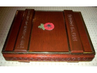
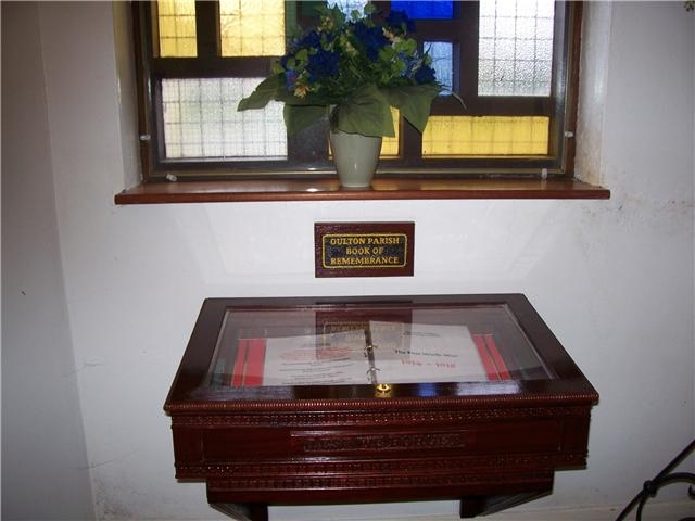

Above: The Oulton Parish Book of Remembrance to Honour the Brave and Resolute Men of Oulton and Oulton Broad who gave their lives in the Cause of Freedom in WW1, WW2 and the Falklands War.
This was designed, carved and constructed (free of charge!!) by Councillor William Robertson and presented to the Oulton Community Church on behalf of Oulton Parish Council and was fitted within the sanctuary altar area. The book takes the form of a hinged box which when opened is laid within a green felt lined display cabinet. The contents of the book were printed/laminated then held in place by a 'ring binder' central spine. A dedicated website for the above was also designed (see information on the final page of this website) by Councillor William Robertson. (Above photos © W.Robertson).
Update May 2016: Sadly the Oulton Community Church has now closed for worship. The Book of Remembrance has been removed from the church and it will eventually be installed in the parish church of St.Michael's.
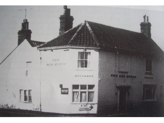


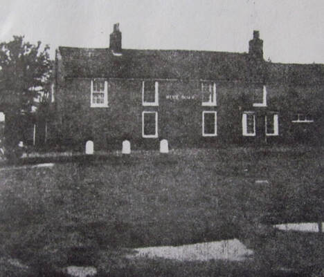
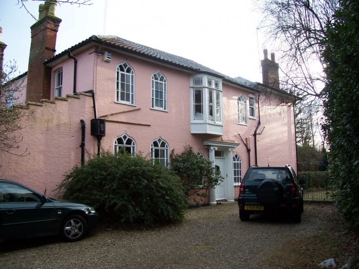
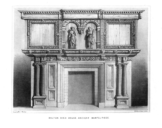
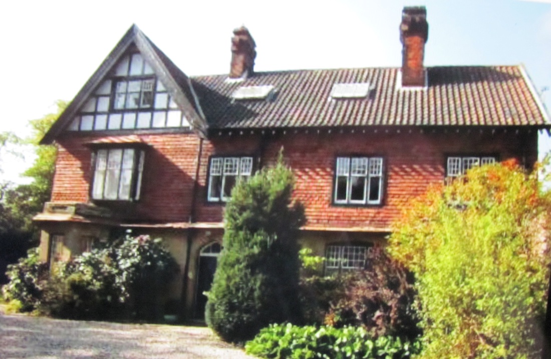
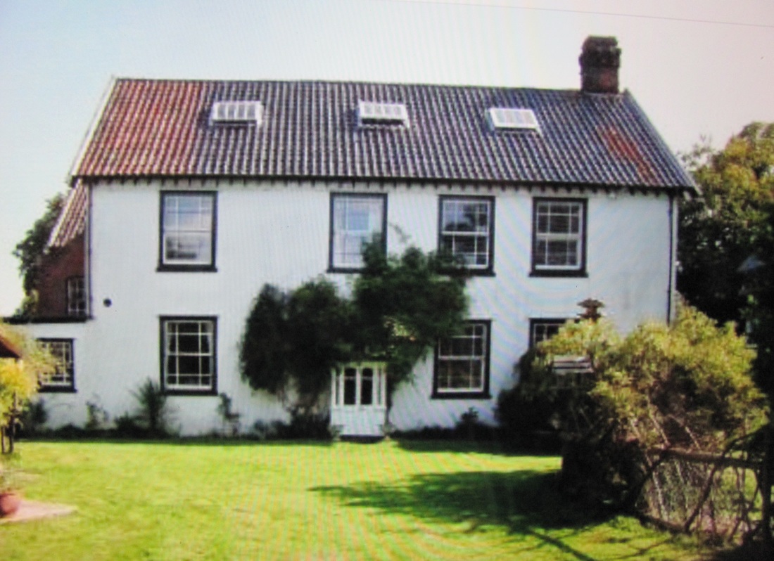
Above - Some old photos: LEFT - The 'Red House' Public House which was demolished in the late 1960s. It stood on the north corner of Union Lane on the now busy B1375 - This road was reclassified when Millennium Way was constructed, having previously been the A1117. The main entrance was very close to the road edge. If the pub was still there then no doubt this would present a hazardous situation to any pub user!!! CENTRE - The Hall - built around 1790 - which stands concealed on the right just past the Oulton Road/Union Lane/Oulton Street crossroads heading northwards. It is now divided into two separate dwellings - 'The Grange' (north side) - 'The Hall' (south side). This building should not be confused with 'Oulton Hall'. The original 'Oulton Hall' was situated at the western end of Hall Road , Oulton Broad near the bend as it joins Christmas Lane. RIGHT - Oulton Manor House is known locally as Oulton High House.

Above: Taken December 2008. (© W.Robertson). LEFT: The site where the 'Red House' once stood. The north corner of Union Lane. CENTRE and RIGHT: Two views of The Hall. Centre is the north side dwelling (now named 'The Grange') and right is the south side dwelling (which retains the name of 'The Hall' ). Boundary railings are just in front of the vehicle on the right of the centre photo. There are two separate (concealed behind hedgerows) entrances from the B1375.
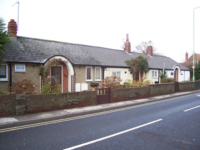

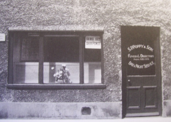
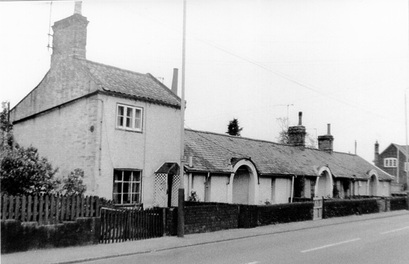
Above: LEFT - The three Alms Houses in The Street. These were built in 1774 as homes for the poor, paid for by charity. They are now privately owned. CENTRE LEFT and RIGHT - The same building. The left photo is as it looks at present (photo taken in 2008), whilst the right photo is the frontage when it operated as a funeral services business (S.P.Poppy and Son) up until the 1960s. It has been pointed out that the sign in the window offers a saw setting and sharpening service!! Quite a few years ago the building may have helped to sober up a few drinkers, as it was positioned midway between the Blue Boar Inn and The Red House!! RIGHT - The house with the arched doorway was for many years the village shop and Post Office. Now converted back into a private dwelling. Its recent closure was a great loss to the village. Another small shop operated in Oulton Road for a number of years but that too suffered the same fate. However a large Aldi supermarket, situated nearby (off Millennium Way), has recently been built and opened for business in January 2009. Therefore in some respects the supermarkets are giving back something to the villagers of Oulton. (Photos © W.Robertson - except the shop front photo)
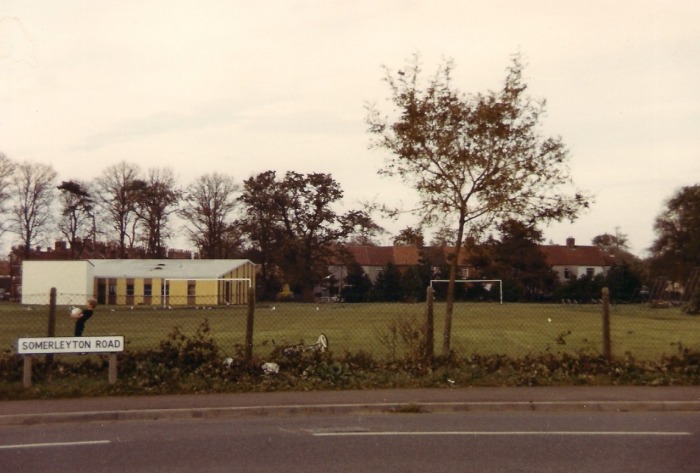
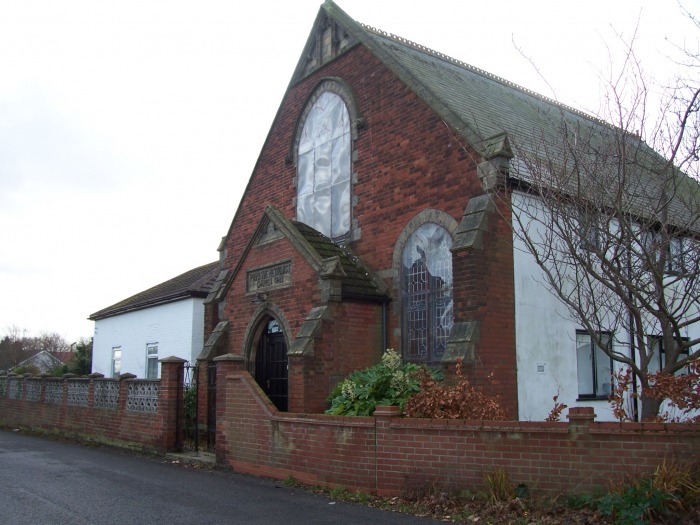
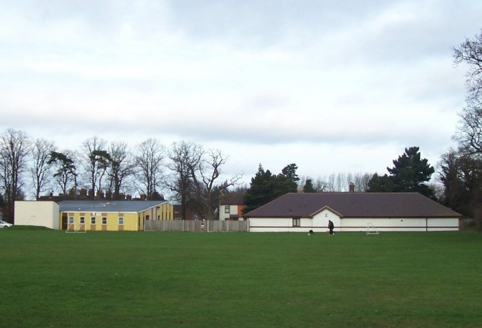
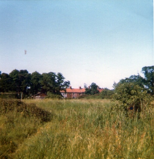
Above: (© W.Robertson). LEFT - A view of the meadow and Community Centre, from Somerleyton Road (1987). CENTRE - A view (2008) of the Oulton Corner Methodist Chapel in Oulton Road North. This has now been converted into a private dwelling. RIGHT: A view of the meadow, Community Centre and the Medical Centre from Somerleyton Road (2008).
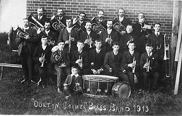
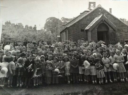
Sadly some of these young men probably went off to war after the photo was taken and never returned.
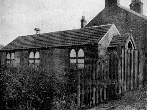
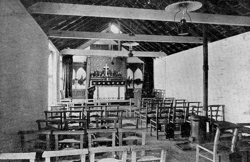
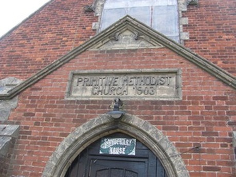
At this time the church was referred to as Oulton Corner Mission Room.
The above two photographs kindly supplied by Capt. Paul McDonough, Church Army - the Pastoral Minister for Oulton Community Church. They were scanned from a 'Garden Party' leaflet, found in some St.Margaret's Church, Lowestoft papers. The leaflet was produced in 1908 and the Garden Party was held to raise funds for the Mission Room.
**********************************************************************************************************


*************************************************************************************************************

*******************************************************************************
(open the slideshow link below to view the individual pieces of equipment)
| omofa_ppshow.ppsx |
